Every map, every dispatch, every delivery starts with the same piece of data – where you are. For nearly half a century, GPS has helped the world find its place. But GPS performs best when one critical condition is met: a clear line of sight to satellites thousands of miles overhead. The moment that line is broken, the location it gives becomes less accurate.
Introducing NextNav’s 5G-powered 3D PNT solution. Our ground-based complement and backup to GPS leverages 5G networks to deliver location data where satellite signals can’t reach. To demonstrate this, the NextNav team headed to the rooftop of a parking garage in San Jose to show how NextNav’s 5G PNT Network performance compares to GPS in a real-world environment.
The team positioned the two systems side by side on the rooftop. The first was a smartphone receiving GPS signals from space. The other was a NextNav device receiving 5G signals transmitted by the company’s 5G PNT Network. Both registered locations in close proximity to their actual position.
But when the NextNav engineers moved the equipment down two floors with physical barriers between the devices and the GPS satellites, the results told a very different story. Without a direct line of sight, GPS accuracy was significantly degraded. But NextNav’s system remained as accurate as it was on the rooftop, providing not only the latitude and longitude but also the device’s vertical height in real time. This provided a full 3D view of the device location.
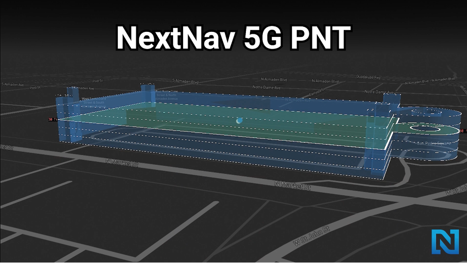
Caption: A 3D visualization on the parking garage showing the position of NextNav’s device, including the Z-Axis (vertical height)
By optimizing the lower 900 MHz band of spectrum, the Federal Communications Commission can enable a ground-based, 5G-powered 3D PNT solution that can complement and backup GPS.
NextNav’s 5G-powered 3D PNT solution is built to reach the places where GPS can’t and provides a critical indoor and vertical location accuracy that the moment demands.