Our entire experience of location technology is based on a 2D world. When you look at a map on your phone, when you get directions in your car, even when you follow the route of an airplane at 30,000 feet, the earth looks flat – feels flat.
As a result, most of us are conditioned to think of location in a 2D way. Our very sense of location is dulled. When we started to rollout NextNav Pinnacle – our vertical location service – we realized early on that the way people think about location would have to change.
Current location technologies simply lack the means to show a full 3D world in all its glory and complexity. In the absence of a visual language for 3D location, NextNav would have to invent one – or at least invent the visual alphabet.
Building the framework
But wait, don’t 3D maps already exist? Isn’t there already a visual language for 3D geolocation out there? Yes and no.
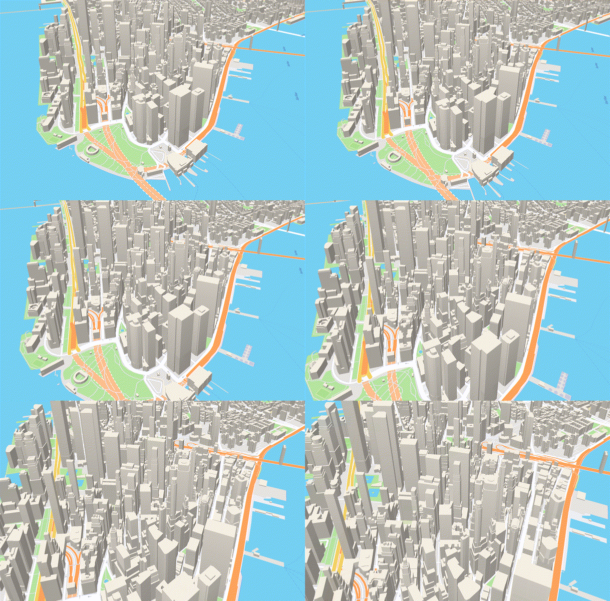
Most of the major mapping providers offer a 3D view, which allows you to see buildings as polygons instead of flat rectangles.

Looks impressive, doesn’t it? But how useful are those images?
Think of those polygons like a movie set – the façade looks great, but there’s nothing inside. While they render well, the polygons on these “3D maps” are nothing more than empty shapes pasted on top of a flat, 2D landscape. They aren’t populated with data – about heights of floors, floor numbering, or anything else. As far as the back-end mapping infrastructure is concerned, those buildings are still in 2D.
If you try to add vertical location data to those polygons, today’s mapping applications don’t know what to do. They essentially see those buildings as a single floor, and don’t have a way to portray anything higher. The blue dot which portrays your location will always stay on the ground floor.
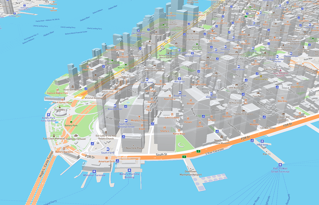
The result? Visual confusion. Just look at what happened when you try to put 2D labels on a “3D map”:

Here’s another thing: those buildings are huge! Some are over 1,000 feet tall and have over 100 floors.
Even if a blue dot could be shown inside a building, would it be meaningful if the dot itself covered 10 floors? These images are going to be viewed on six inch screens, by people on the go. Creating a great user experience for this kind of thing isn’t going to be easy.
This is what we mean when we say that a new visual alphabet is needed. Without a way to display a meaningful visualization of vertical location inside those polygons, 3D location doesn’t end up meaning much.
Introducing the NextNav altimeter
Until mapping applications have access to a rich data set of building interiors, we’re going to need a bridge solution – one that integrates with the limited 2D world of existing location technology while pointing to the future state that will someday bring us into a truly 3D world.
Enter the NextNav Pinnacle altimeter.
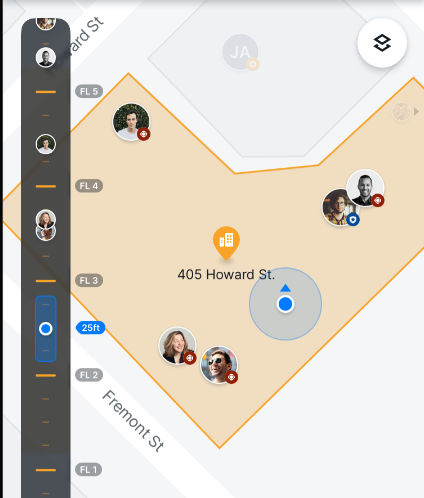
We’ve created a simple, elegant, lightweight solution which adds a vertical dimension to existing 2D maps. This new visual element provides additional location context, essentially telling you how high up you are in relation to the surrounding terrain and other people.
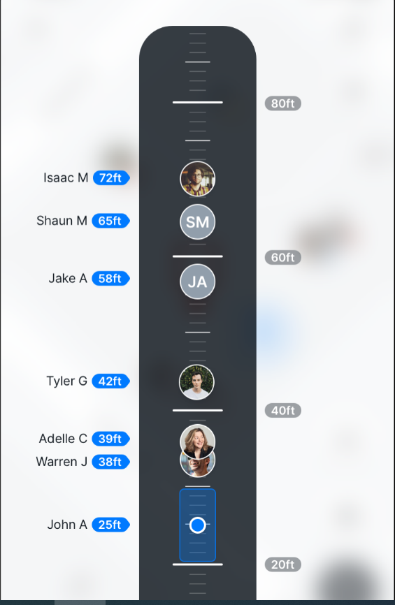
Today’s maps don’t provide a way to place a blue location dot at the correct place inside a building. Even if that were possible, the dot may be difficult to understand in a tall building with multiple points of interest. The altimeter gives you a vertical location reading which helps to complete the picture, without overcomplicating or cluttering the visual landscape. Here’s what it looks like:

We’ve set up the altimeter to provide a basic sense of vertical location at a glance, but also the ability to dive deeper into the details. Here are some of the features of NextNav’s altimeter:
- Height reference measurements which are adjustable based on the application and use case (these are the gray markers in the picture above)
- Adjustable measurement systems (metric/imperial)
- Support for both Height Above Terrain (HAT) and Height Above Ellipsoid (HAE)
- Support for both above and below grade measurements
- Range measurement indicator (shown as a blue cylinder – the altimeter equivalent of the blue dot)
- When an application features multiple people sharing their location, everyone will appear as avatars on the altimeter, allowing you to see where you are in relationship to other people
- When you click on a cluster of avatars close together, the altimeter expands so you can see their vertical relationship in greater detail
This version of NextNav altimeter is our first shot across the bow. We’re working on a bunch of additional features which will appear over the next several months.
Integrating the NextNav altimeter
From an application development perspective, the NextNav altimeter is easily added to existing location infrastructure. The altimeter view is included in the visualization package contained in the NextNav SDK, and integrates seamlessly with any mapping application.

Here’s how it works:
The host app starts the process by creating map fragment. It then calls the NextNav SDK, generating a series of callbacks to gather data from the device and the NextNav cloud. The NextNav SDK then creates the altimeter visualization, building out all of the rendering and scale.
For application developers, it couldn’t be easier. All you have to do is add the NextNav SDK into your host application by connecting to the Pinnacle service with your developer key. The visualizations will appear automatically, on top of Google Earth, HERE, Mapbox, other Google mapping products, or whatever else you use.
Taking the first step
It’s clear to us that creating visually rich 3D geolocation applications won’t happen overnight. There’s an entire ecosystem of data and back-end infrastructure changes which will have to be in place before the true power of 3D geolocation really comes to light.
In other words, there isn’t going to be a Wizard of Oz-type moment where we go from the black and white, 2D world into a technicolor masterpiece of 3D geolocation. The best we can do right now is the equivalent of a colorized movie – one which provides visual clues about the way things really are, but can’t yet provide the full experience.
We know that a bigger, more impressive change is coming, and NextNav is excited to lead the way there. As our altitude network comes online and we roll out the SDK to developers in key market segments, this ecosystem of 3D location is clearly gaining traction. The altimeter is a small but significant step in what promises to be a monumental journey ahead.
Learn more about NextNav Pinnacle for vertical location, then get a Pinnacle developer key in our partner portal.