On Independence Day, Americans turn to the heart of our nation, Washington, D.C., and the Washington Monument in particular. A proud obelisk of marble and granite, it stands as a symbol of American strength and endurance and is the backdrop for the fireworks display used to mark our freedom. It’s also a fortress, with walls so thick they are notoriously impenetrable to the satellite-based GPS signals our world has come to depend on.
For public safety, this represents a critical challenge. In an emergency, knowing a caller’s horizontal location is only half the story. In a multi-story structure, the vertical dimension—the Z-axis—is what can lead first responders to navigate to the incident as fast as possible, which saves lives.
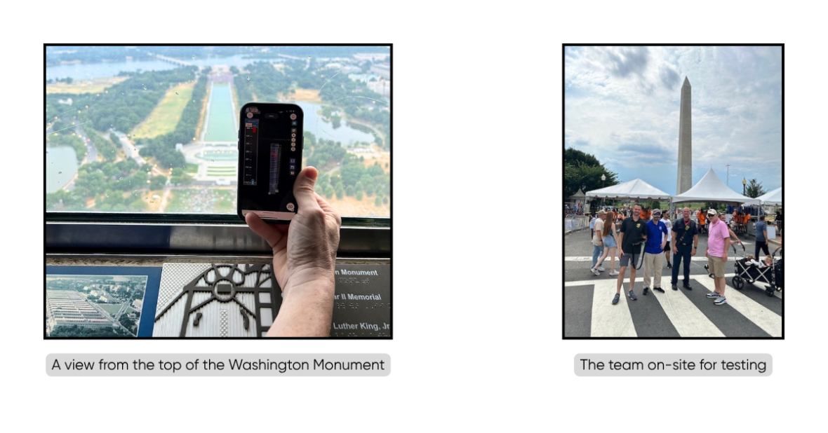
Last July 4th, amidst a celebration with well over 200,000 people taxing local cellular networks, NextNav, in partnership with forward-thinking public safety agencies, undertook one of its most ambitious tests to date. The mission: to prove the accuracy, reliability, and resilience of our Pinnacle Z-axis service and 3D visualization tools in one of the most challenging environments imaginable.
This second phase of testing, led by the Arlington County Fire Department and the Arlington County Department of Emergency Communications 9-1-1 Center, and hosted by the DC Homeland Security and Emergency Management Agency, was specifically designed to assess performance under the most strenuous, real-world conditions.
The Challenge: A Real-World Gauntlet
Success required overcoming three immense obstacles simultaneously:
- Structural Interference: The Washington Monument’s dense building materials are known to block or degrade conventional location signals. During the test, this proved true for legacy GPS, whose X/Y coordinates became wildly inconsistent.
- Network Congestion: The massive July 4th crowd placed cellular networks under extreme load, creating the perfect environment to validate the resiliency of NextNav’s services during a mass gathering event.
- Complex Scenarios: The tests simulated life-or-death public safety incidents, requiring accurate tracking of multiple “9-1-1 callers” and “first responders” as they moved through the structure.
The Test: From the Metro to the Monument
After initial validation in Arlington and successfully tracking personnel through subterranean Metro stations, the team arrived at the National Mall for the final and most demanding tests at the Washington Monument. Using standard smartphones equipped with the NextNav Pinnacle View and 3AM FLORIAN applications, the team ran two critical scenarios.
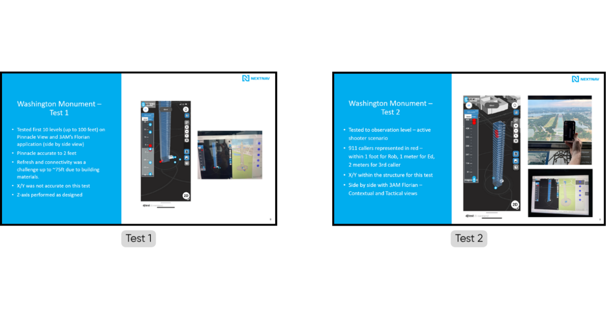
Scenario 1: The 100-Foot Ascent
In the first test, a team simulating “9-1-1 callers” ascended the monument’s stairwell to the 100-foot level, followed by a “first responder” team.
Scenario 2: The Observation Deck Under Load
The final test simulated an active shooter scenario during peak crowd congestion. Three “callers” ascended to the 500-foot observation deck just before the fireworks display began.
The Results: A New Standard in Geolocation
The conclusions from this comprehensive testing are clear and transformative for public safety:
- Pinpoint Z-Axis Accuracy: By integrating height data, emergency responders can pinpoint a caller’s location in three dimensions, drastically improving response times and accuracy, both above and below ground. NextNav’s service independently exceeds the FCC’s mandate for ±3 meter vertical location accuracy.
- Unwavering Resilience: The service performed reliably during a mass gathering where cellular services were heavily stressed, proving its dependability when it’s needed most.
- Powerful 3D Visualization: The ability to visualize the location of callers and responders on a 3D map is an invaluable tool, providing incident commanders with immediate, intuitive situational awareness.
This exercise was more than a technology demonstration; it was a validation of the future of emergency response. The ability to precisely locate someone vertically inside a building is no longer a wish—it’s a reality.
As our nation celebrates its independence, NextNav is proud to be delivering a new level of freedom: freedom from the two-dimensional limitations of the past. By providing the critical Z-axis, we are empowering first responders, enhancing public safety, and building the next generation of 3D PNT for a safer and more connected world.